America’s southwest desert is an interesting, spectacular and wonderful place. Outdoor recreation opportunities abound there, but they come with costs.
One such cost is wonderfully described in the ultra-classic, older climbing guidebook to the soft sandstone of Sedona, Arizona. In its chapter called “Sedona Plants,” the book claims that botany in this area is really very simple. It is simple because plants in the desert fit into just one of two categories: those plants that hurt, maim, or kill, and those found in places other than Sedona. Desert plants, says the author, are equipped with “arsenals” and they don’t attack singly, but in numbers.
The name of this climbing guidebook, by the way, is “A Better Way to Die.”
I’ve spent huge amounts of time in this area’s deserts over many years. Joshua Tree, Red Rocks, the Eastern Sierra Nevada, I’ve even climbed a fair amount in Sedona. And so I've experienced a lot of these "killer plants." I've also seen the beauty of this land and enjoyed moving over it. But I’ve never backpacked in the desert; indeed, I’ve never gone more than a few miles into the back country.
All this came to a head a few months ago, when Laura Dawson happened upon a relatively new, long desert trail during a PCT-related internet search. Laura called this trail to my attention. Just hearing the name left me immediately interested. It’s called The Grand Enchantment Trail. It starts east of Phoenix, Arizona (the GRAND Canyon state) and extends to just west of Albuquerque, New Mexico (the land of ENCHANTMENT). A total of 770 miles. The trail is still a fairly new concept, mostly traveling already existing trails, but requiring some linkups through rougher, or, alternatively, more civilized country.
More than just the name was interesting to me. The idea of exploring the back country of an area I barely knew was exciting. Trying out a mountain range called The Superstitions sounded fun. I guess it would be fair to say that my first exposure to the trail left me a bit “enchanted.”
But I couldn’t find as much detail about the G.E.T. as is available for other long trails like the PCT and the Arizona Trail. This is easy to understand; G.E.T. has only existed as a concept for less than a decade and it takes time to plan and implement the creation of a trail such as this. I was able to find just one “guidebook” online and some maps to go with it.
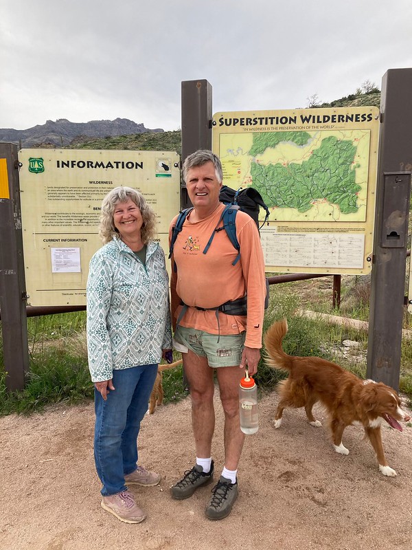
Vicki and I had planned this year what’s become an annual southwest desert van trip. We often wander on these trips with barely any itinerary. Normally I get in a little climbing and the dog(s) and I hike a lot.
This year I asked Vicki to support me in at least a start on this trail. I wanted to start with Segment One, 30.3 miles through the Superstition Wilderness from the trail's start, just east of Phoenix. In planning though we could not find a four wheel drive vehicle to borrow or to beg a ride. So I decided to make it a 34.2 mile hike instead: I’d hike the most difficult part of the road out from the pickup trailhead to meet Vicki.
The Trail starts in the Superstition Wilderness, less than five miles from Lost Dutchman State Park. We staged there with this view of the Superstition Mountains:


Climbers will be interested to know that there’s a fair amount of climbing on the spires to the left in the photos. On decent rock too.
The trail begins at the very popular First Water Trailhead:

Naturally our older dog Halifax would join me on this backpack. The younger girl Digby wasn't big, strong or experienced enough yet to do more than hike out the first half mile with Vicki. That didn't stop her from having fun though (between this area and Joshua Tree and all the stuff in between though Digby gained a huge amount of desert experience on this trip - she'll go with us next time):


Note the water that the girls are playing in. This was a very pleasant surprise in an area that the guidebook called "very dry." At least usually. As an example, the "first reliable water" on this part of the trail is nine miles from the start. But not this trip. Arizona's weather has matched California's to a large extent this winter and the amount of water we encountered was, according to locals I talked to, amazing.
The first few miles of the trail included easy ups and easy downs. The tread was very obvious and brush cleared well to the sides of the trail. These are mostly typical views from the trail's first six miles:


I say "mostly" above because although almost everything in sight was relatively flat desert with some ridges and valleys, "the" needle wasn't:

"The" needle is Weavers Needle. I use "the" because none of the people I saw on the trail used anything other than "the needle." It's a huge spire that dominates the view from everywhere in six miles (and, for climbers, it has several multi-pitch climbing routes on it and features two cleared and flat tent camping spots on its summit).

Once past the needle, the trail follows canyons and (usually dry) creeks until they aren't helpful and then moves over ridges to new such features. Boulder Creek and then over and across the heavily flowing Needle Creek:


We spent the second half of the first day in La Barge Canyon. Very pretty, very wet and cliff-lined in parts:


Midway up La Barge we reached that first reliable water at Charlebois Spring (pronounced "Charlie Boy Spring"). It flows from the canyon which touches the right side of this photo:

“Charlie Boy’s” water didn't matter to us on this trip, only it's beauty.
Trail conditions started to deteriorate after we passed Charlebois. The Grand Enchantment Trail is a connection of already-existing trails, but this far into the wilderness, these already-existing trails were in pretty poor condition. Although the trail tread stayed good (this would NOT be the case for most of day two), heavy brush crowded the trail up here. And this intruding brush wasn't the type "...found in places other than Sedona." Instead, at this point, it was brush which (only) hurt.
First among this brush was acacia, or in common nomenclature, Cat's Claw. Why call a plant "Cat's Claw?" Well, this is a good and relevant question. For those who haven’t “played” with Cat’s Claw, picture a plant of variable size. From hip high to a small tree. Spindly and long branches which are covered with thorns. But not normal thorns. No wimpy rose-like thorns out here in the desert. Instead the thorns on Cat’s Claw are like cat’s claws. They curve inward. Brush against one thorn and it hooks in and pulls the whole branch at you. Normally a hiker can continue along, but claw after claw after claw catch and pull and slow. Some even cut and tear. It’s nasty stuff - Mother Nature making barbed wire look child-like.
And above Charlebois long stretches of trail had Cat’s Claw lining both sides. Naturally the Cat's Claw was mixed in with cactus (at least seven kinds), the occasional Ocotillo (wow, what absolute needles for spines). There was even some run of the mill scrub oak and other relatively harmless plants protruding onto the trail.
Still, the weather was great, we had plenty of water, the trail tread was obvious, and we were moving along at a good pace. The canyon narrowed into Upper La Barge Box and we eventually found a place to camp with water, a flat spot and… acacia everywhere. It worked. Camp for night one:


